

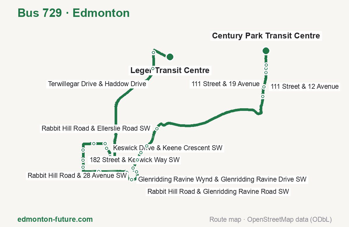
Bus 729 in Edmonton links Leger Transit Centre and Century Park Transit Centre. The route is 22.3 km long with 25 stops, and the official schedule from Edmonton Transit Service puts the full trip at about 43 minutes. On a weekday it runs 38 trips in one direction.
Route at a glance
| Mode | Bus |
|---|---|
| Route number | 729 |
| City | Edmonton |
| Transit authority | Edmonton Transit Service (ETS) |
| Start → end | Leger Transit Centre → Century Park Transit Centre |
| End → start | Century Park Transit Centre → Leger Transit Centre |
| Route length | 22.3 km / 22.1 km in the opposite direction |
| Number of stops | 25 / 23 in the opposite direction |
| Travel time | about 43 minutes |
| Trips per day | 38 on weekdays one way |
| Frequency | peak 20–30 · midday 22–30 |
| First / last trip from «Leger Transit Centre» | 05:44 / 21:42 |
| First / last trip from «Century Park Transit Centre» | 05:29 / 21:53 |
| Fare | 3.75 $ |
| Updated | August 22, 2026 |
Route of Bus 729
Outbound: Leger Transit Centre → Century Park Transit Centre
This direction has 25 stops and runs 22.3 km. The route passes Terwillegar Drive & Riverbend Road, Kostash Drive & Hiller Road SW, Glenridding Ravine Drive & Rabbit Hill Road SW, Rabbit Hill Road & Glenridding Ravine Road SW. Below is the full list with the distance from the first stop.
| No. | Stop | From start | Note |
|---|---|---|---|
| 1 | Leger Transit Centre | 0.0 km | Terminus |
| 2 | Terwillegar Drive & Riverbend Road | 1.0 km | |
| 3 | Terwillegar Drive & Haddow Drive | 1.7 km | |
| 4 | Keswick Drive & Keswick Gate SW | 6.6 km | |
| 5 | Keswick Drive & Keene Crescent SW | 7.0 km | |
| 6 | 175 Street & Hiller Road SW | 7.3 km | |
| 7 | Kostash Drive & Hiller Road SW | 7.8 km | |
| 8 | 182 Street & 15 Avenue SW | 8.5 km | |
| 9 | 182 Street & Keswick Way SW | 8.9 km | |
| 10 | 182 Street & Keswick Drive SW | 9.2 km | |
| 11 | Keswick Link & 28 Avenue SW | 10.1 km | |
| 12 | Glenridding Ravine Drive & Rabbit Hill Road SW | 11.4 km | |
| 13 | Glenridding Ravine Wynd & Glenridding Ravine Drive SW | 11.8 km | |
| 14 | 159 Street & 28 Avenue SW | 12.4 km | |
| 15 | Rabbit Hill Road & 28 Avenue SW | 12.6 km | |
| 16 | Rabbit Hill Road & Glenridding Ravine Road SW | 13.0 km | |
| 17 | Rabbit Hill Road & Glenridding Ravine Road SW | 13.4 km | |
| 18 | Rabbit Hill Road & Glenridding Ravine Road SW | 13.8 km | |
| 19 | Rabbit Hill Road & Ellerslie Road SW | 14.7 km | |
| 20 | 111 Street & 9 Avenue | 20.3 km | |
| 21 | 111 Street & 12 Avenue | 20.7 km | |
| 22 | 111 Street & 19 Avenue | 21.4 km | |
| 23 | 111 Street & 19 Avenue | 21.5 km | |
| 24 | 111 Street & 23 Avenue | 21.7 km | |
| 25 | Century Park Transit Centre | 22.3 km | Terminus |
Inbound: Century Park Transit Centre → Leger Transit Centre
This direction has 23 stops and runs 22.1 km. The route passes 111 Street & Saddleback Road S Ent, Rabbit Hill Road & Glenridding Boulevard SW, Glenridding Ravine Drive & Rabbit Hill Road SW, 182 Street & Kulay Green SW. Below is the full list with the distance from the first stop.
| No. | Stop | From start | Note |
|---|---|---|---|
| 1 | Century Park Transit Centre | 0.0 km | Terminus |
| 2 | 111 Street & Saddleback Road S Ent | 1.2 km | |
| 3 | 111 Street & 12 Avenue | 1.9 km | |
| 4 | 111 Street & 9 Avenue | 2.3 km | |
| 5 | Rabbit Hill Road & Ellerslie Road SW | 8.2 km | |
| 6 | Rabbit Hill Road & Glenridding Boulevard SW | 8.7 km | |
| 7 | Rabbit Hill Road & Glenridding Boulevard SW | 9.1 km | |
| 8 | Rabbit Hill Road & 21 Avenue SW | 9.5 km | |
| 9 | Rabbit Hill Road & 28 Avenue SW | 9.9 km | |
| 10 | Glenridding Ravine Drive & 28 Avenue SW | 10.2 km | |
| 11 | Glenridding Ravine Wynd & Glenridding Ravine Drive SW | 10.7 km | |
| 12 | Glenridding Ravine Drive & Rabbit Hill Road SW | 11.2 km | |
| 13 | Keswick Link & 28 Avenue SW | 12.4 km | |
| 14 | 182 Street & 28 Avenue SW | 13.1 km | |
| 15 | 182 Street & Keswick Drive SW | 13.3 km | |
| 16 | 182 Street & Keswick Way SW | 13.7 km | |
| 17 | 182 Street & Kulay Green SW | 14.1 km | |
| 18 | Kostash Drive & Hiller Road SW | 14.8 km | |
| 19 | Keswick Drive & Hiller Road SW | 15.3 km | |
| 20 | Keswick Drive & Koshal Way SW | 15.5 km | |
| 21 | Keswick Drive & Keswick Gate SW | 15.9 km | |
| 22 | Terwillegar Drive & Haddow Road | 20.8 km | |
| 23 | Leger Transit Centre | 22.1 km | Terminus |
Schedule and frequency
According to the official schedule from Edmonton Transit Service, the route runs 38 trips in one direction on a weekday.
| Direction | Weekdays | Weekends and holidays |
|---|---|---|
| From «Leger Transit Centre» | 05:44 — 21:42 | — — — |
| From «Century Park Transit Centre» | 05:29 — 21:53 | — — — |
Frequency calculated from the departure table: in the morning peak buses run every 20–30 minutes, most often every 20; midday every 22–30 minutes; in the afternoon peak every 25–34.
Fare and payment
A single ride costs 3.75 $. The same fare applies to buses and LRT in Edmonton.
Tapping an Arc card, credit or debit card costs $3.00 and covers 90 minutes; cash or a paper Arc ticket costs $3.75 for the same 90 minutes. There is no monthly pass — instead the Arc card stops charging once you reach $102.00 in a month, or $10.50 in a day. Transfers within 90 minutes are free. The fare itself covers 90 minutes, so transfers within that window cost nothing extra.
Frequently asked questions
How much does a ride on bus 729 cost?
3.75 $ for a single ride.
When do the first and last trips run?
From Leger Transit Centre the first is at 05:44 and the last at 21:42. From Century Park Transit Centre they are 05:29 and 21:53.
How long does the trip from Leger Transit Centre to Century Park Transit Centre take?
About 43 minutes end to end — the median of full trips in the official schedule.
How many stops does the route have?
25 outbound and 23 inbound according to the official GTFS feed. The two lists do not match exactly.
Does bus 729 run on weekends?
Yes, the route runs every day, with a separate weekend schedule.
Every route number with its termini, operating hours and travel time is collected in the Edmonton buses overview.
Data current as of August 22, 2026. Schedule and termini — Edmonton Transit Service (ETS). Fares — City of Edmonton, ETS fares and passes. Stop list, schedule and route geometry come from the official GTFS feed (City of Edmonton Open Data).